Long winding backstory
Mas não, mas não
A Cidade Ideal, by Chico Buarque
O sonho é meu e eu sonho que
Deve ter alamedas verdes
A cidade dos meus amores
E, quem dera, os moradores
E o prefeito e os varredores
Fossem somente crianças
I grew up in a “metropolitan suburbia”. Which is to say a suburb now solidly nested within one of the world’s largest metropolises. A neighborhood structured as a car-centric suburb, but located in what can only be described as an urban area. I am sure to write more about this in other articles, so I will try to focus here on one aspect of this environment: its child unfriendliness. With my two-week old son sleeping in the next room as I write this, this topic is frequently in my mind these days.
When you are one of the lucky kids that enjoy the modern luxury of freedom from child labor, what do you do with all that time you have? You play, of course. Who doesn’t remember a time when you didn’t want to go to bed because that would mean you’d have to stop playing? Oh, the wonders of childhood… Right, but where do you play?
To middle-class kids in São Paulo, there were several options: at school, inside your own house, inside a friend’s house, in the private playground of your (or your friend’s) condominium, and… that’s kind of it. The obvious omission here being playing on the street.
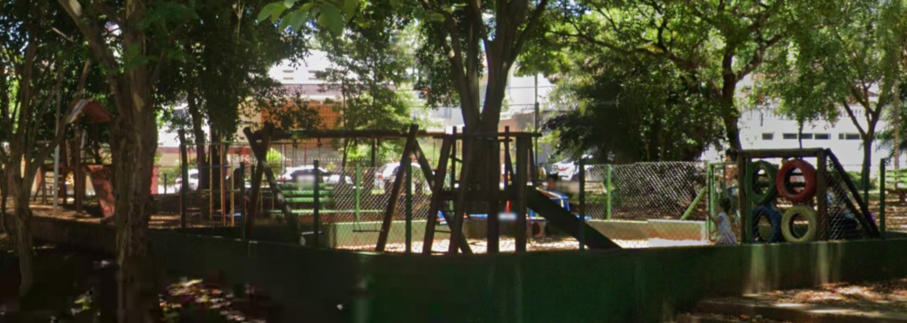
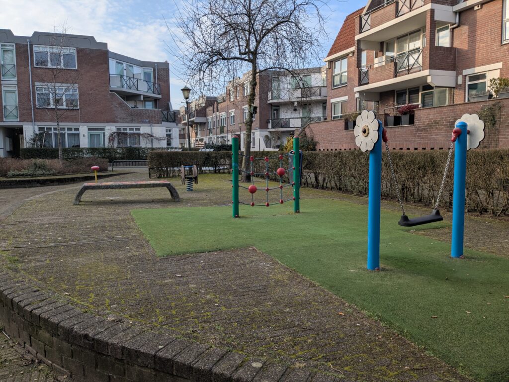
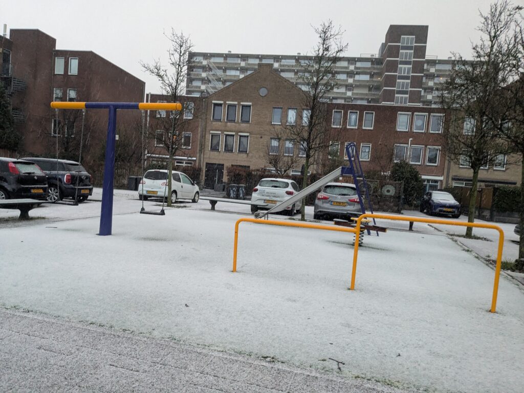
I am being overly critical, as I certainly played outside countless times, even though my “class” was admittedly above “middle” for our city. Shout out to the playground outside my school, pictured below. But I have always had the sense that kids played less and less outside, specifically in public spaces, with a shift towards the shelter and parental supervision of private spaces.
It was always clear to everyone that changes in the built environment were related to this. I mean, my granddad used to swim in what later became one of the most polluted rivers in the world. But he was born when the population of the city was – let me check – a twentieth of what it is today. I’m also cheating here, because that was over a century ago, but the point stands. Urbanization then, surely, must be at the root of this trend.
Well, kind of. I would argue that it’s not necessarily that we built the city, but rather how we built it, and for whom.
Car traffic is incompatible with human life, insofar as you tend to die when hit by a moving vehicle. Which is why walking with a toddler is stressful: even when everything is fine, you must maintain unwavering attention to that fragile bumbling newly-biped whose guidance is apparently based exclusively on the principles of Brownian motion. It is a low level of attention that is required, constantly calculating your safety margin if the kid darts straight towards the road and you have to run after them, but it is a level of attention that must be maintained constantly, possibly at the penalty of death. I think that’s why parents feel so relaxed in a shopping mall or a theme park, the calculations of “seconds away from fatal injury” are much more reassuring there.
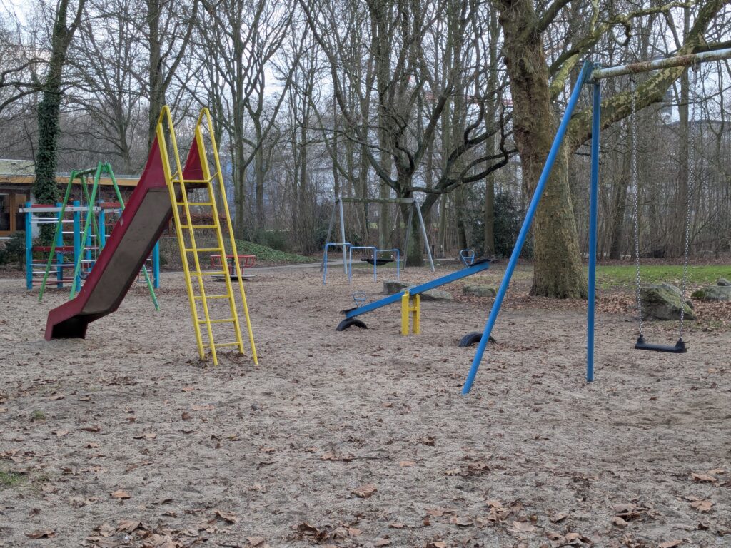
This is where playgrounds come in. A semi-fenced area where kids can play outside, without as much parental fear of them being run over. Thing is though, most people can’t afford the space and equipment for a worthwhile play area on their own grounds. But perhaps, if we pooled our resources, we could have some sort of big collective “back yard” with recreational equipment made from something other than thin plastic and questionably-welded carbon steel. Public playgrounds also come with the benefit of allowing for socialization, community forming, and up-to-date insight into vandalism in your local area.
I am not really qualified to give an insightful take on this, so instead I’ll just link to two videos from the undisputed world champion in “foreigners glazing up Dutch infrastructure”, Not Just Bikes. This is a good summary of why the Netherlands are a great place to raise children, and this one specifically talks about Dutch public playgrounds.
Short introduction
There seems to be some laws and regulations requiring Dutch municipalities to make sure their public playgrounds are adequately maintained. I’m sure liability concerns are another motivator. From what I understand, this one company sells to municipalities their own information system for conducting inspections and maintenance on these public facilities. But the great thing is they made a website, BuitenSpeelkaart, that shows all public playgrounds from partner municipalities.
I don’t think this tool is very well known, but I found it to be incredibly useful as a parent. In this article, I will go over how I have used it, and write about some of those experiences.
Map of playgrounds
There is a plot I’ve made, but this article is mostly about my appreciation of one that had already existed. In this case, markers on a map showing where all the playgrounds in my city of Schiedam are located.
When you have children, going out to explore the world is very healthy. You might already be tired of “the world”, but young kids still have to give it a try. As an immigrant from a quite different place, I wanted to make sure my daughter got to know the country she was born into, since it feels to me like a privilege we’ve worked for instead of simply being the place where we are. But going out is just as healthy for the parent, as an (often desperate) attempt to not go crazy trying to take care of a child at home.
This is how I found buitenspeelkaart useful. When you are out and about you can check your phone for nearby playgrounds. You can also look up in advance for ideas of new places to explore with your kid. It can show you the way in a city you are visiting, but it also reveals all the spots in your own area that you likely didn’t know existed.
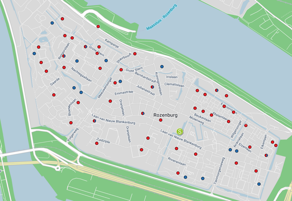
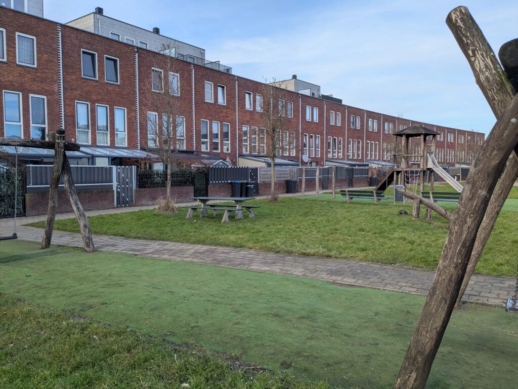
My perception of Dutch city design is that residential areas often have local streets with significant traffic calming, or fully pedestrianized spaces protected by modal filters, that act like public courtyards. If you don’t live there, there is likely no reason to pass by those places, which often feel like communal backyards. It is in those places, sheltered from car traffic, that public playgrounds hide from view. Raising a child gave me this new perspective on the urban environment, and the playground map was a useful tool that guided me in discovering the city I had already been living in for years. There were so many great public places nearby that I had no idea were there!
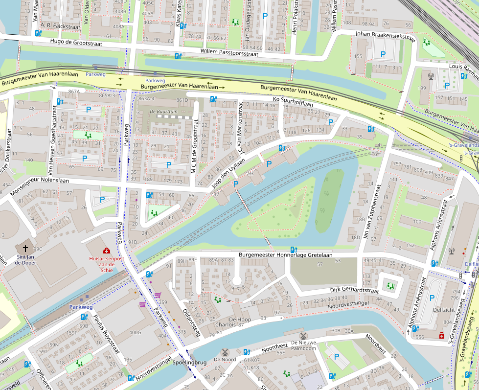
On the map below of part of Schiedam you can see how tucked away these play areas are, out of the way of through traffic. Also notice just how many of them there are:
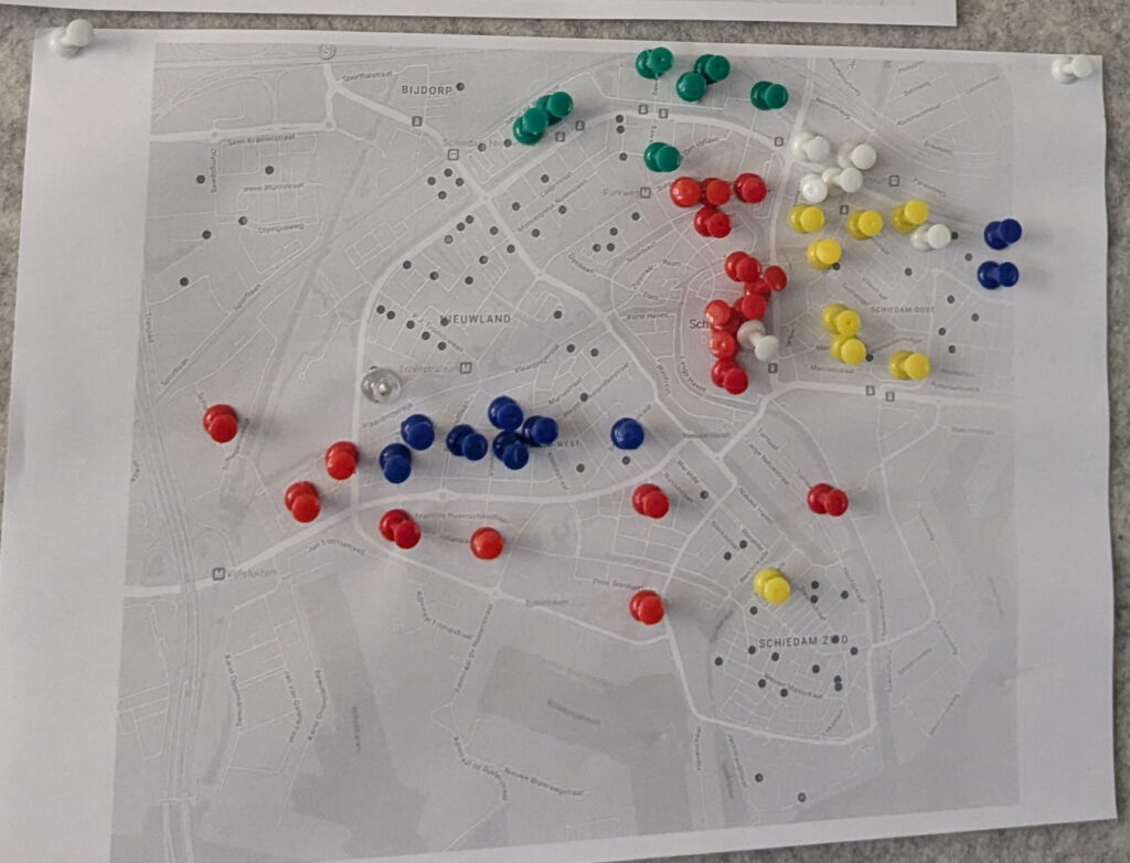
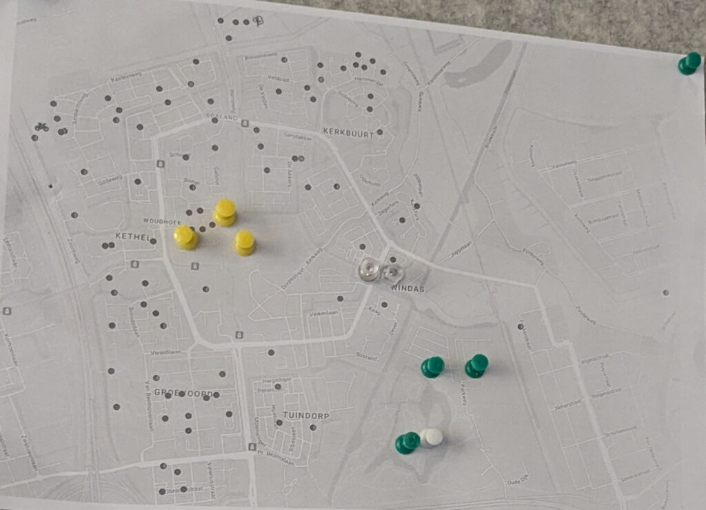
As my daughter started walking and making use of playgrounds, I had the idea of printing the map from BuitenSpeelkaart and putting pins on the ones we already visited. It could be a fun quest to explore all of the city’s playgrounds. My rules were that she had to use at least one equipment for it to count, and I would also mark the sport facilities that we happened to walk by, as she was too young to make use of those.
After intense activity during the range of 1–2 years old, our routines changed with more daycare, more toys at home, and a more grown up person with her own say on what we should do. But by that time, having tried out dozens of places, we established our go-tos for different occasions. The big playground in the Princes Beatrixpark is easily the best overall, if you are wondering, but there are a lot of hidden gems. In the end, we were far from 100% completion, but the two sheets of paper remained as a reminder of all the fun we had along the way.
You will notice that the prints above are slightly different than the current (2026) version of the map. In the last year, Schiedam added a more detailed classification of playgrounds, which differentiate them by size and facilities. Below is an example of the simpler scheme still used in other places.
The new scheme has more information, although it is a harder to read. As each municipality handles their own facilities, the classification can also be a little inconsistent across borders. That is to say what is considered a “small playground” (kleine speelplek) in one city, might be equivalent to a “neighborhood playground” (buurt speelplek) elsewhere.
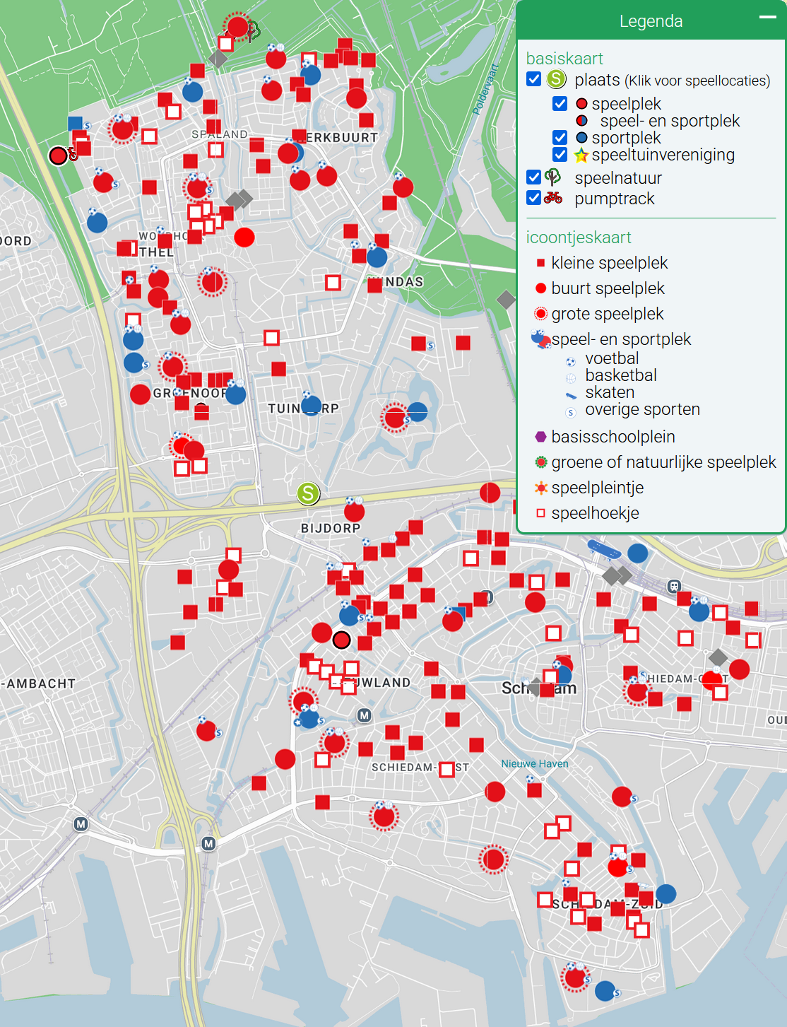
Quick Dutch recap: speel = play, plek = place, hoekje = (small) corner, kleine = small, buurt = neighborhood, grote = big. For our purposes here, we can ignore the details and just think of four size classes of playground, as exemplified below.
For today’s figure, my objective was to make my own version of the map for Schiedam, indicating whether or not I have visited each playground. I could have just used photoshop (GIMP) on the screenshot earlier, but this project is all about artisanal, fair trade, data visualization. So I plotted a new map “from scratch”.
(Data) hamster on the playgrounds
The heading is just a shoehorn to mention that data hoarding is called “data hamsteren” in Dutch. There’s so much valuable knowledge that my supervisor and science mentor taught me, and yet this factoid she told us six years ago is what my brain chooses to retain. Anyways, how did I get the playground data?
The buitenspeelkaart website draws the markers on the map locally, which means I could save some .json files from the web browser, in which the playground data was stored. The format was pretty straightforward, giving me a list of locations with their coordinates.
I discarded the purely “sport” locations, and the ones marked as “overig” (other), which I think were all places closed for renovation. With the printed paper full of pins hanging next to me, I manually set each entry as “visited” or not.
Map of the quest
For the base map, I used the default layer of OpenStreetMap, saving rasterized tiles accessed with their API. OSM is not just open, but also much better than Google Maps at showing urban features. This has the benefit of giving my figure a different flavor to buitenspeelkaart, which uses the latter.
For aesthetic reasons, I also wanted to highlight the area of the municipality of Schiedam by partially blanking out everything outside it. So I downloaded the official municipal boundaries, reading them with geopandas.
Thankfully I already knew that the Dutch love to use their own official CRS (coordinate reference system), called Rijksdriehoeksmeting. They’ll have you know that old man Snellius pioneered surveying by triangulation (note that driehoek is Dutch for triangle, or literally “three-corners”). Still, getting cartopy to use the right CRS took me longer than it should have.
Another complication was that I didn’t want to paint the Schiedam shape I just got, but rather the areas outside it. To do that, I made a big Netherlands-sized rectangle and set the Schiedam contour as an interior hole to the polygon (see shapely documentation for more info). But when I plotted this feature, the facecolor was painted everywhere, inside and out. Eventually I figured out what the problem was: the inside of a donut runs counter to the outside—I should have paid more attention to Calculus classes.
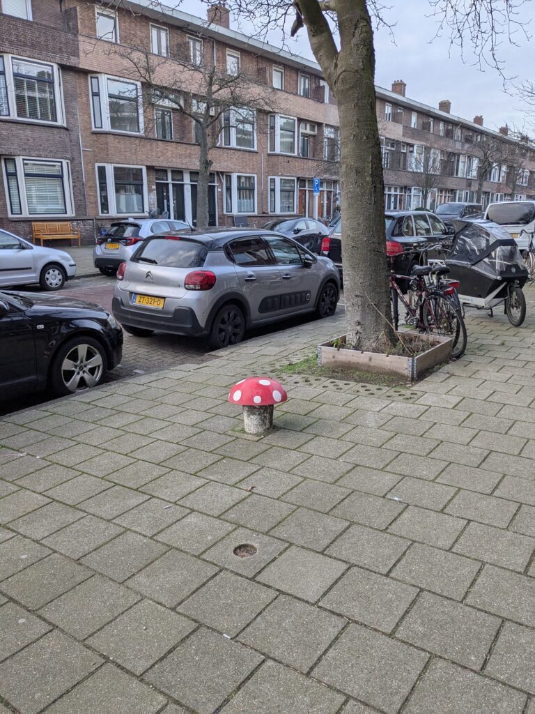
Formatting-wise, a major challenge was choosing the right markers. I feel that the buitenspeelkaart icons don’t give a good representation of the significance of each place. If anything, the icon for speelhoekjes, such as that mushroom above, draw more attention than the icon for grote speelpleks. The red and blue colors, while they stand out more from the background, also didn’t seem like the best choice. I thought the map should look like a video game overworld,with the markers indicating whether a “level” was completed or not. In the end, I settled on four different shapes and sizes, with a gold color for “visited” and gray for “not visited”.
There were some other small quirks in preparing the figure too. I used the Century Gothic font instead of the matplotlib default (DejaVu Sans), which didn’t feel “mappy” enough. An unusual arrangement of three legends was chosen as a way of having somewhat tabular counts of playgrounds, and since the shape of the city left plenty of space for them on the sides. Using two different markers for each entry in the legend is also not very conventional, but I think it looks great:

Some 85 years ago the old municipality of Kethel en Spaland was merged into Schiedam. But because they (later) built the A20 highway between them, the city still feels very divided, with the town of Kethel tagging along only for administrative purposes. This is why I thought it best to show the numbers for each part separately.
Quest complete?
Overall, we visited 50 different playgrounds, just in Schiedam—not bad! Some only once, just to be able to put a pin on the map. Others, our favorites, were visited countless times.
Despite this, as the map clearly shows, we were far off from 100% completion. In fact, considering just the “south of A20” area, we got 39% of locations. 46% if we ignore the smallest class, speelhoekjes.
My justification for that is there are just so many playgrounds! To prove my point, I looked up population per age bracket per postal code on CBS. Not that CBS, I mean the Centraal Bureau voor de Statistiek, the Dutch national institute of statistics. There are fewer than 9000 people aged 0–10 years living in Schiedam, giving an average of 59 children per public playground, not counting the speelhoekje variety:
| Area | Population 0–10 yr | Children per playground (g+b+k) | Children per playground (g+b+k+h) |
|---|---|---|---|
| North of A20 | 2975 | 46 | 36 |
| South of A20 | 5940 | 70 | 53 |
| All of Schiedam | 8915 | 59 | 46 |
Perhaps we would build much better cities if we designed them for children instead of cars.
Sour note
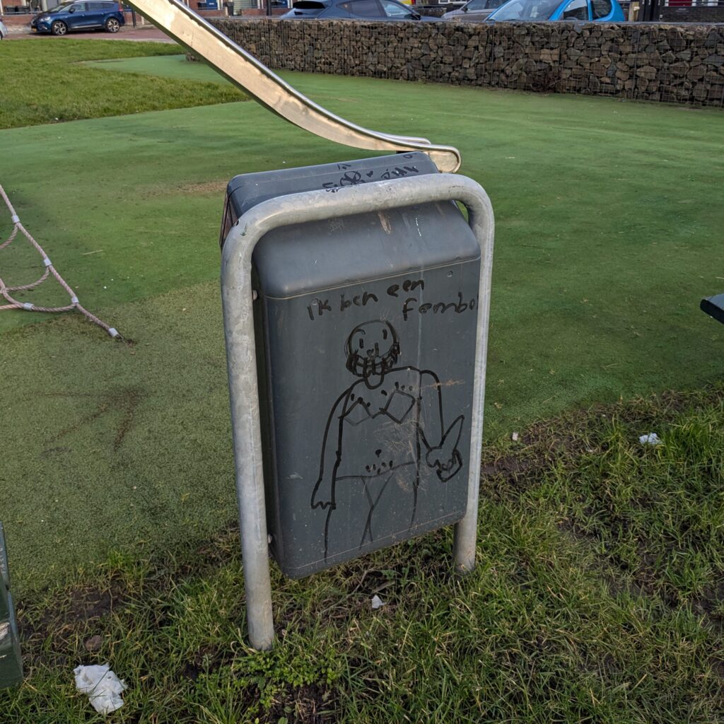
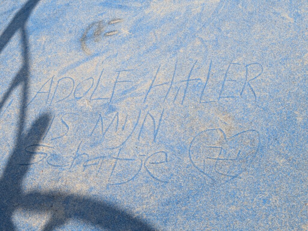
Because this post is too rosy for my chronic pessimism, I feel compelled to at least say something bad at the end. Public playgrounds can give you hope in society, but… Maybe some children are just irreparably bad people and we are doomed as a species.
As an example, below are a couple of pictures of (very mildly) defaced playgrounds, with things I futilely wish my children could live their whole lives without ever having to lay their eyes upon. I suppose some people just desperately crave to be noticed, to be seen or heard. But in failing to draw attention for something valuable, I guess being annoying, destructive, or confrontational is a guaranteed way of not feeling insignificant.
[trigger warning: mood ruining edgy offensive messages on playgrounds]
So I guess the moral here is that good infrastructure is instrumental in facilitating a healthy, happy and memorable childhood. The public aspect of these installations also help in developing social skills, a sense of shared environment, and a feeling of belonging within society. However, it is still up to the parents to give an education and raise someone into a mature, empathetic, sociable person that isn’t a bratty self-centered hateful dick.